
How Police Drones Support Incident Command
Police drones support incident command by giving commanders an aerial view of an incident, helping them assess hazards and direct resources. Their value depends on how well the drone team turns observations into information that supports a decision. A live video feed alone does not establish what has happened or what responders should do next.
For emergency services, the practical challenge is connecting the aircraft to the command structure. Clear tasking, reliable reporting and agreed limits make aerial observations more useful, particularly when several agencies are working together and conditions are changing.
How police drones contribute to incident command
An incident commander needs information that is relevant, timely and clear about uncertainty. An aerial team can contribute to that picture, but its observations must sit alongside reports from officers on the ground, control rooms and other responding agencies.
The JESIP joint working principles place shared situational awareness alongside communication and jointly understanding risk. Applied to drone operations, this means sharing an observation in a form that other responders can understand and use, rather than assuming everyone watching the same footage reaches the same conclusion.
A useful aerial report identifies the location, observation time and anything that limits confidence. It also distinguishes an observed fact from an interpretation. “A person is standing beside the eastern gate” is different from “the person is preventing access”. The second statement needs supporting context.
Used this way, police drones help commanders test assumptions without treating an overhead view as a complete account of the incident.
Match the aerial task to a command decision
“Get a drone overhead” is an incomplete instruction. The team needs to know which question the commander wants answered and when the answer will stop being useful.
A defined task might be checking whether an access route is obstructed or examining a search area before a ground team enters it. Each requires different positioning and reporting.
| Incident | Useful aerial question | Command decision supported | Limitation to report |
|---|---|---|---|
| Missing-person search | Is there an observable person or heat source in the assigned area? | Where to send search teams for further checks | Vegetation, cover and incomplete visibility |
| Major road collision | Where are the queues and visible obstructions? | How to position resources and assess access | Conditions outside the camera view |
| Industrial incident | What visible hazards or obstructions affect approach routes? | Where to stage responders | A camera cannot establish atmospheric safety |
| Perimeter operation | Is there observable movement in a defined sector? | Whether to reposition ground resources | Blind spots and interruptions in coverage |
| Large public event | Where are congestion or blocked routes developing? | Where to send ground teams to assess conditions | Perspective can distort apparent density |
These are decision-support tasks, not promises of detection. Police drones should report what the sensor can establish, leaving identification and conclusions about intent to appropriate corroboration.
Build a repeatable tasking and reporting workflow
Define the question before launch
Record the incident reference, requesting commander and purpose of the sortie. Specify the area of interest, the information required and the reporting route. Include a time limit where the decision is urgent.
For example, “check the northern footpath for visible obstructions before the search team approaches” gives the crew a clearer task than “look around the park”. It also helps the commander recognise when the task is complete.
Agree what would justify interrupting the planned task. A newly observed person in immediate danger may need urgent reporting, but routine requests should pass through an identified tasking contact rather than arriving from several people at once.
Separate command requests from aircraft control
The commander sets the operational information requirement. The aviation team assesses whether it can deliver that information safely under the operating arrangements in place.
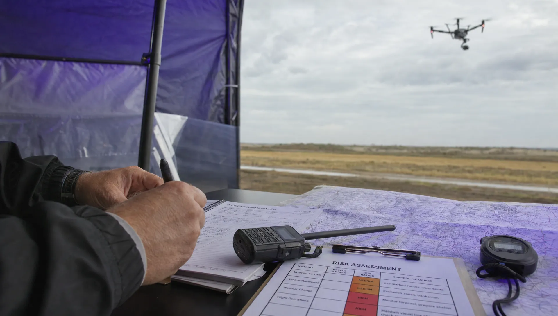
Make responsibilities explicit in the briefing. The remote pilot needs capacity to manage the aircraft, airspace and changing conditions. Where staffing allows, a separate sensor operator or liaison officer can interpret tasking and communicate observations.
This separation helps police drones remain useful when radio traffic increases. A pilot should not have to choose between monitoring the flight and answering several competing requests. Make it clear that the crew can pause or stop a sortie on safety grounds.
Report observations with time and uncertainty
Use a consistent reporting format that includes observation time, location, what was seen and any limitation. Add the action requested, if there is one.
A hypothetical report might read:
“Observed at 14:32, grid square B4: one unidentified heat source beside the eastern hedge. No corresponding visual identification. Ground team check requested; part of the hedge remains obscured.”
That report is more useful than “we have found someone”. It preserves uncertainty and gives responders a location they can act on.
When police drones provide live video, distinguish the time of capture from the time someone receives or repeats the observation. A delayed feed or frozen frame can otherwise be mistaken for current information. Use a consistent time reference across incident records.
Reassess the task and plan the handover
Aerial information becomes stale. A clear route may later become blocked, while a person can move beyond the observed area between reports.
Agree when the commander needs an update and what should trigger immediate notification. Mark the last confirmed observation time rather than presenting an old assessment as current.
Plan for battery changes, communications failure and the end of the deployment. Tell command when coverage stops, which areas remain unchecked and whether another resource has taken over. If the feed fails, the incident should have a fallback reporting method rather than continuing as though aerial observation remains available.
Recognise what the aircraft cannot establish
Thermal imaging can reveal temperature differences that merit investigation, including in darkness. It does not reliably identify a person or explain what they are doing. Thermal cameras do not see through walls, and vegetation or other cover can prevent useful observation.
Visible-light cameras also have limits. Viewing angle, glare and low light can make an object difficult to interpret. Zooming into one area reduces awareness of activity elsewhere.
For incident command, police drones are most useful when these limitations travel with the report. “No person observed in the visible part of the field” is defensible; “the field is clear” may not be.
Coordinate with other aviation resources through the agreed arrangements. Helicopters and additional drones introduce interactions that the commander may not see on the video feed. An urgent information request should not pressure the crew into continuing when safe separation or reliable aircraft control is uncertain.
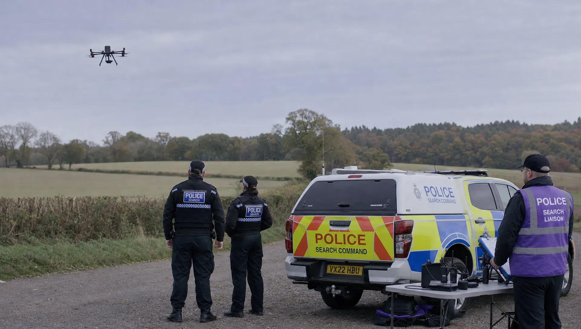
Keep operational intelligence and evidence handling distinct
A live feed used to direct responders and a recording retained for an investigation serve different purposes. Decide who needs access to each and avoid distributing footage more widely than the task requires.
For police drones, the operational record should connect the request with the observation and subsequent reporting. Record changes in tasking, interruptions in coverage and uncertainties that affected interpretation. Where footage is retained, follow the force's procedures for preserving originals, recording access and documenting any exported copies.
Flight records serve a different function from camera footage. They can support review of aircraft activity, but they do not explain everything the crew observed or why a commander made a decision. Keep a link between the sortie, incident record and relevant media without treating one record as a substitute for the others.
Before using external services such as the DJI flight log analysis tool, check force information-security requirements. Do not upload operationally sensitive files without approval. Access permissions, retention decisions and external processing should follow the organisation's agreed policies.
Measure usefulness to command, not just flight activity
Flight totals and airtime describe activity. They do not show whether the aerial team answered the question that prompted deployment.
A more useful debrief examines how quickly the team supplied actionable information, whether command understood its limitations and whether that information changed resource allocation. Record unanswered questions too. An incomplete search sector should not disappear from the incident picture simply because the sortie ended.
Review performance across deployments rather than judging the programme on its most successful recording. Police drones may provide value by confirming that a proposed route needs further assessment or by identifying an area that another resource must inspect. Neither outcome necessarily produces dramatic footage.
Look for repeatable improvements: clearer task requests, fewer conflicting instructions and better handovers. Where the team could not help, identify whether the cause was unsuitable tasking, sensor limitations or an operational constraint. That distinction supports better decisions about training and equipment.
Frequently asked questions
Do police forces in the UK use drones? Yes. UK police forces use drones for activities including missing-person searches, incident assessment and investigative work. Aircraft, sensors and deployment arrangements vary between forces, so capabilities should be confirmed with the attending team.
Can police drones replace helicopters at incidents? They can support some observation tasks, but they are not interchangeable with helicopters. Endurance, operating conditions and the required coverage affect which resource is suitable. Command should request the capability needed rather than assume either aircraft can perform every task.
Should every commander watch the live video? Not necessarily. A designated person can monitor the feed and provide concise reports, allowing commanders to focus on decisions. Direct viewing is useful when it answers a specific question, but it should not replace structured reporting or ground confirmation.
What should happen when aerial coverage stops? Command should receive an explicit update stating when observation ended, the last confirmed findings and any remaining gaps. Decisions should then use that information alongside other available sources, not assume the last image remains current.
Review the planning behind each deployment
A useful exercise is to trace one recent sortie through its tasking, reports and handover. Check whether another person could establish what was requested, what the crew observed and when coverage ended.
When assessing operations software, use those requirements to guide your review of Dronedesk's published features. Confirm any force-specific security, hosting and integration requirements directly before making a procurement decision.
 How Police Drones Support Incident Command →
 FAA Drone Flight Regulations for Operations From Moving Vehicles →
 DJI Remote ID Compliance Checks When Renting Aircraft →
 What a Drone Site Selection Tool Can Miss About Ground Access →
 How to Brief Clients on Drone Restrictions Near Airports →
 How to Choose the Best Drone Logbook for Shared Aircraft →
 How to Find and Read the FAA BVLOS ARC Report →
 FAA Drone Registration Rules When Transferring Company Assets →
 Remote Pilot Competency Evidence for Utility Procurement Teams →
 Drone Flight Log Fields to Standardise in Excel Across Teams →