
Choosing Drones for Agricultural Use Beyond Crop Spraying
Choosing drones for agricultural use starts with the farm decision, not the aircraft catalogue. A grower investigating uneven crop growth needs different data from an estate manager inspecting roofs or a contractor mapping drainage features. Buying a spraying platform will not necessarily help with any of those tasks.
For operators building an agricultural service, the useful starting point is a defined output: a scouting map, a measured field model, an inspection report or a repeatable record of change. The sensor, aircraft and processing workflow should follow that requirement.
This guide focuses on agricultural work beyond spraying, including how to choose suitable equipment, assess practical coverage and turn aerial images into information a farm can actually use. It also explains when hiring a specialist makes more sense than owning equipment.
Match drones for agricultural use to a specific decision
Before comparing aircraft, write down what the farm will do differently after receiving the data. “Monitor crop health” is too broad to specify equipment or judge whether a survey was worthwhile. “Identify patches requiring an agronomist’s inspection before the next treatment decision” is a usable brief.
| Agricultural task | Useful starting sensor | Deliverable | Main limitation |
|---|---|---|---|
| Locate uneven emergence or lodging | RGB camera | Georeferenced image map with marked patches | Causes still need investigation |
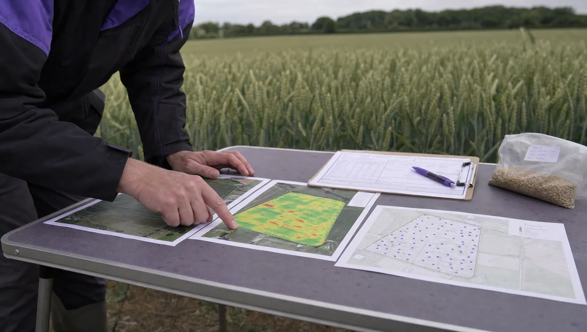
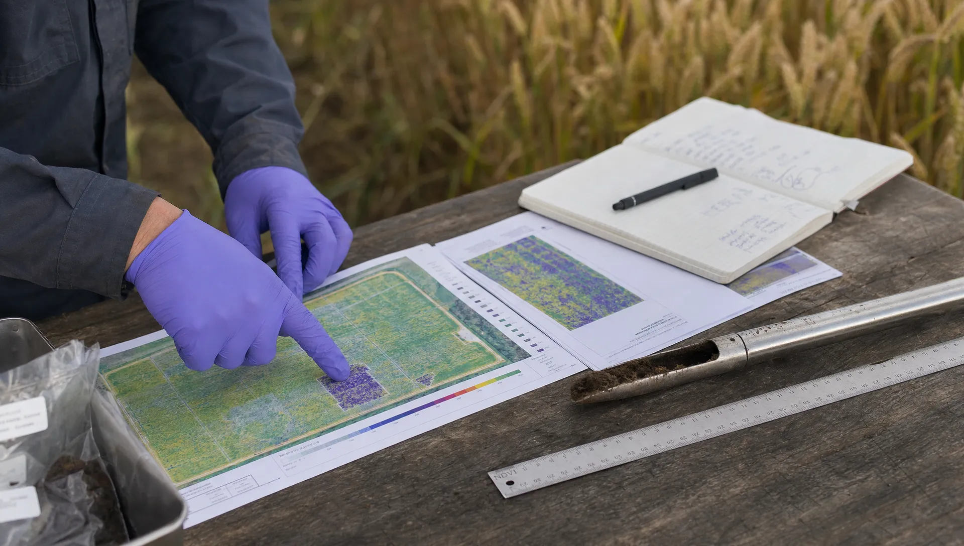
| Compare crop vigour within a field | Multispectral camera | Calibrated vegetation-index map | Index values are not a diagnosis |
| Investigate drainage patterns | RGB camera, sometimes thermal | Terrain context and mapped observations | Vegetation can obscure the soil surface |
| Inspect roofs, tracks and fences | RGB camera with suitable detail | Annotated inspection photographs | Hidden defects remain unseen |
| Support livestock searches | Thermal and RGB cameras | Located observations for follow-up | Cover, weather and disturbance affect usefulness |
Agree the required detail, delivery date and person responsible for interpretation before selecting hardware. A technically impressive map has little value if it arrives after the management decision.
Choose the sensor before the aircraft
RGB cameras for scouting, mapping and inspections
For many teams assessing drones for agricultural use, a good RGB mapping workflow is the most practical starting point. Ordinary colour imagery can reveal crop gaps, storm damage, standing water and access problems without requiring specialist spectral interpretation.
Mapping performance depends on more than megapixels. Check camera calibration, image sharpness, shutter behaviour and whether the aircraft supports the repeatable image-capture pattern your processing software needs. A camera suited to attractive aerial photographs is not automatically the best mapping camera.
RGB imagery also suits many farm infrastructure inspections. Specify the smallest defect or feature that must be visible, then test whether the proposed camera can resolve it from a safe working distance.
Multispectral cameras for measured crop comparisons
Multispectral sensors capture selected wavelength bands, often including near-infrared. These support vegetation indices such as NDVI, which can help distinguish areas of differing crop vigour.
The interpretation needs care. A low index value could reflect sparse emergence, nutrient stress, waterlogging, disease or exposed soil. Dense vegetation can also make some indices less sensitive to further differences in crop condition.
Ask how the system handles reflectance calibration and changing illumination. Repeat surveys need a consistent method if the intention is to compare dates rather than simply find contrasting patches within one flight.
Thermal cameras for specific investigations
Thermal-equipped drones for agricultural use can support livestock searches and investigations into crop water stress, but they need a clearly defined survey method. A warm patch is an observation, not proof of a particular problem.
Sunlight, wind, wet surfaces and survey timing affect thermal contrast. Foliage can hide animals, while a heat signature alone may not establish species or condition. Confirm observations using RGB imagery and appropriate ground checks.
For irrigation work, avoid treating a thermal image as a direct measurement of root-zone moisture. Pair it with crop observations and soil measurements relevant to the question being investigated.
Compare aerial surveys with existing farm methods
A drone provides a different viewpoint, not an automatic replacement for field walking, satellite imagery or machinery-mounted sensors.
Satellite data can be useful for broad, repeated observations without deploying a flight team, although cloud and spatial resolution may limit a particular task. Field walking provides close inspection and physical samples, but covering a large area takes time. Tractor-mounted systems collect information during field operations, though their availability depends on access and the work being undertaken.
The strongest case for drones for agricultural use is often targeted coverage: collecting detailed information at a chosen time, then directing people towards areas that need closer inspection.
Environmental benefits should be tied to a measured change in practice. A map does not itself reduce fertiliser, water or fuel use. Record the management action it informed and compare outcomes before claiming a saving.
Specify data quality and realistic field capacity
Separate image detail from measurement accuracy
Ground sampling distance describes the ground represented by an image pixel. It does not establish the positional accuracy of the finished map.
RTK or PPK positioning can improve georeferencing, but the complete workflow still matters. Camera calibration, image overlap, processing choices and independent checkpoints affect confidence in measurements. Checkpoints should test the output rather than also being used to fit it.
For drainage or earthwork decisions, agree vertical accuracy and the height reference with the person using the results. A surface model over a standing crop represents the visible canopy, not necessarily the soil beneath it. Do not promise a drainage design from imagery that cannot resolve the required ground levels.
Test coverage using the required deliverable
Compare drones for agricultural use by completed survey output, not advertised flight duration alone. Coverage changes with image resolution, overlap, wind, field shape and the distance between the launch site and survey area.
Battery changes, relocation, pre-flight checks and data checks all consume working time. A higher-resolution brief may require more flying and processing than a broad scouting survey of the same acreage.
Ask for a demonstration using representative fields and the proposed sensor. Record usable area captured, total time on site and any reflights. Check access to suitable take-off areas, charging arrangements and safe separation from farm activity. Wind tolerance on a specification sheet is not a guarantee of usable imagery in those conditions.
Build a workflow that produces reliable decisions
Make repeat surveys comparable
Document field boundaries, crop growth stage, sensor settings and the capture method. Keep flight height, overlap and lighting conditions consistent where the survey objective requires comparison over time.
Plan around the farm’s working schedule. Livestock movements, contractors, irrigation equipment and machinery can change access or make an otherwise suitable launch location impractical. Arrange who can stop nearby activity if conditions change.
Keep flight records alongside the survey job so that missing coverage or an interrupted mission can be investigated. For DJI flight-log analysis, Dronedesk’s log viewer is a resource for reviewing flight data. Flight records support investigation, but they do not replace checking image quality and map accuracy.
Check aerial observations on the ground
The value of drones for agricultural use depends heavily on what happens after landing. Sample contrasting areas rather than inspecting only the most dramatic patch on a colour-coded map.
For example, compare a low-vigour patch with a nearby area of normal growth. Record plant population, visible symptoms, soil condition and recent management history. Involve the farm’s agronomist where interpretation will inform treatment.
Avoid assigning a cause solely from colour. Similar-looking patches may need different responses, and a visually striking difference may not justify intervention. Record uncertainty in the report rather than hiding it behind a precise-looking map.
Deliver files the farm can use
Agree formats before flying. Depending on the receiving software, these might include a GeoTIFF orthomosaic, vector boundaries or a simple annotated PDF. Confirm the coordinate reference system, units and file-size limits.
A prescription map needs more agreement than a scouting report. Check the machinery’s accepted format and have the responsible agronomist approve treatment decisions and rates.
Our drone mapping software comparison can help you assess the processing stage. Test a sample export in the farm’s actual system before committing to a platform.
Check UK permissions against the proposed operation
When planning UK work with drones for agricultural use, establish the applicable requirements for the aircraft, location and exact activity before accepting the job. Use the CAA’s current drone guidance as the official starting point rather than relying on a supplier’s general assurance or an old training summary.
The planning brief should identify the aircraft, people involved, nearby activity, airspace and intended flight profile. Confirm what registrations, competency evidence or permissions apply to that particular operation. Keep the answers with the project documentation.
If the scope later includes spraying or spreading, obtain a fresh assessment covering the proposed operation and exact substance. Consult the relevant authorities, including the HSE’s pesticide guidance where applicable, rather than transferring assumptions from camera-only work.
Operational safety also needs farm-specific planning. Discuss livestock disturbance, overhead wires, public access, neighbouring properties and how the team will respond to an unexpected person or vehicle entering the working area.
Decide whether to buy equipment or hire a specialist
Ownership makes most sense when survey demand is frequent, staff can maintain competence and the business has a complete processing and interpretation workflow. Hiring can be a better fit for occasional surveys, specialist sensors or work where measurement confidence matters more than immediate aircraft availability.
Compare drones for agricultural use on total annual cost, including depreciation, training, insurance, software, maintenance and staff time. Processing and agronomic interpretation can cost more effort than the flight itself.
A simple break-even calculation helps expose assumptions. Suppose annual ownership costs are £4,200, internal delivery costs are £200 per survey day and an equivalent hired service costs £500 per day. The calculation is £4,200 ÷ (£500 − £200), giving 14 comparable survey days per year.
Those figures are illustrative assumptions, not market prices. Replace them with written quotes and your own labour costs. The comparison only works if both options deliver equivalent outputs, including processing and interpretation.
For a contractor testing demand, a paid pilot project with hired equipment or a specialist partner can establish whether customers will act on the deliverable before capital is committed.
Frequently asked questions
Does every farm need a multispectral drone? No. RGB imagery may be sufficient for locating crop gaps, recording storm damage or inspecting infrastructure. Choose multispectral equipment when the required measurement and interpretation justify it, not simply because it is marketed for agriculture.
Can drone imagery diagnose crop disease? Imagery can identify patterns that warrant investigation, but similar patterns may have several causes. Ground inspection, crop history and sometimes laboratory testing are needed to establish the cause and choose a response.
How often should agricultural surveys be flown? Set the interval around the decision being supported. Repeat flights are useful when a change can be detected and acted upon. Crop growth stage, weather, recent treatment and the consistency of the capture method should inform the schedule.
What should a trial survey prove before buying? A trial should show that drones for agricultural use can produce the agreed output on representative fields, within the available working window and at an acceptable total cost. Ask the farm’s intended user to assess the deliverable, not just the aerial photographs.
Define the service before purchasing the aircraft
Start with one repeatable job and an agreed acceptance test. Prove that the sensor captures the required information, that the processing workflow preserves its quality and that someone can use the result.
As the work becomes a repeat service, assess how you will organise clients, aircraft, planning documents and job records. Compare those requirements with the published Dronedesk features before choosing your operations-management setup.
 Choosing Drones for Agricultural Use Beyond Crop Spraying →
 How to Write a Drone Business Plan That Tests Your Margins →
 How to Choose a Search and Rescue Drone for Rural Operations →
 How to Carry Out a Drone Site Survey Before Mobilising →
 How to Evaluate Drone Companies for Long-Term Contracts →
 What a First Responder Drone Programme Needs Before Deployment →
 Law Enforcement Drones and Their Role in Evidence Collection →
 What Are UAV Systems? Aircraft, Payloads and Ground Equipment →
 7 Best Flight Planning Apps for Commercial Drone Teams →
 How Police Drones Support Incident Command →