
Weather App for Drone Flying: Checks Beyond Wind Speed
A weather app for drone flying should help you decide whether the whole mission is workable, not just whether the wind-speed tile is green. Gusts, visibility, precipitation, temperature and conditions at operating height can change a sensible plan into an unsuitable one, even when the headline forecast looks reassuring.
For survey teams, utility inspectors and emergency services, there is another question: will the conditions let you collect useful data and complete the task safely? This guide explains what to check, how to interpret conflicting forecasts and how to turn weather information into a defensible launch decision.
Start with the location, flight window and aircraft
Check the actual worksite rather than the nearest town. A coastal asset, exposed ridge or urban rooftop can experience conditions that differ considerably from a forecast covering the surrounding area. Include the route, working height and expected landing time, not just the launch point.
Next, establish the operating envelope from the aircraft documentation and your mission risk assessment. A published wind-resistance figure is not a guarantee that every flight below that number will be suitable. Payload, battery condition, turbulence and the return route also matter. Use limits relevant to the aircraft configuration and task, with an appropriate operational margin.
Finally, check when the forecast was issued and which period it describes. An hourly value is not a promise that conditions remain constant throughout that hour. Watch for time-zone differences when comparing products.
The useful output from a weather app for drone flying is therefore a site-specific assessment for the whole flight window, supported by observations rather than a single pass/fail icon.
What a weather app for drone flying needs to show
Choose weather tools by the information they expose, not by how confidently they label a day “flyable”. Look for gusts, wind direction, precipitation timing, visibility, temperature and clearly labelled forecast heights. Model comparison and recent observations help you judge uncertainty.
For example, Windy offers forecast wind layers and comparisons between available models. For UK operations, Met Office rainfall radar helps you examine recent precipitation movement. Neither replaces checks at the site.
| Check | What to inspect in the app | What to confirm locally |
|---|---|---|
| Gusts and direction | Peaks, changes and timing | Exposure, turbulence and return-route implications |
| Wind at height | Forecast level and height reference | Terrain, structures and aircraft behaviour |
| Precipitation | Radar trend and forecast arrival | Rain, drizzle or spray at the operating area |
| Visibility and cloud | Fog risk, visibility and cloud base | Whether the aircraft and relevant obstacles remain clearly visible |
| Temperature and moisture | Temperature, humidity and dew point | Battery condition, condensation and lens clarity |
| Forecast confidence | Model agreement and update time | Whether observations match the forecast |
Read gusts and direction, not just average wind
A forecast of 6 m/s with gusts of 11 m/s describes a different operating environment from a steady 6 m/s breeze. Those figures are illustrative, not recommended limits. Short peaks can challenge positioning and increase workload, particularly near structures or during landing.
A weather app for drone flying should make the gust forecast easy to find, but the model cannot resolve every building corner or patch of disturbed airflow. Consider the gap between sustained wind and gusts alongside local exposure, rather than applying a universal gust allowance.
Wind direction also affects energy planning. A downwind outbound leg can become a demanding upwind return. Include the planned return route, any contingency landing options and the effect of the configured return-to-home height in your assessment.
Remember that meteorological wind direction normally describes where the wind comes from. A westerly wind blows from west to east. Check how the app presents arrows before interpreting them against your route.
Check conditions at operating height
Surface wind is not the same as wind along an elevated inspection or mapping route. A sheltered take-off point may give little indication of conditions above nearby trees, buildings or a ridge.
Check the forecast layer’s height reference. Metres above ground level and metres above sea level are different, especially across uneven terrain. Some products also use pressure levels, which do not correspond to one fixed height above your worksite.
When using a weather app for drone flying, treat an elevated wind layer as context rather than a precise measurement along the route. Forecast resolution may be too coarse to represent roof-edge turbulence, valley flows or accelerated wind around structures.
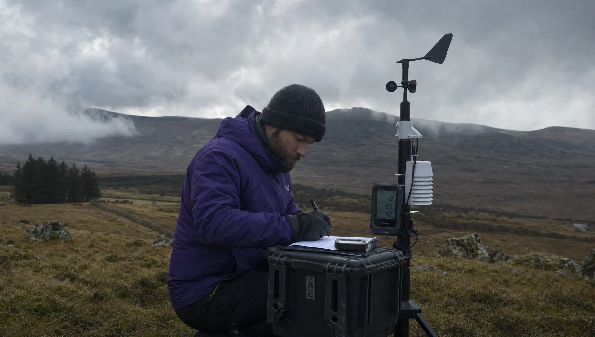
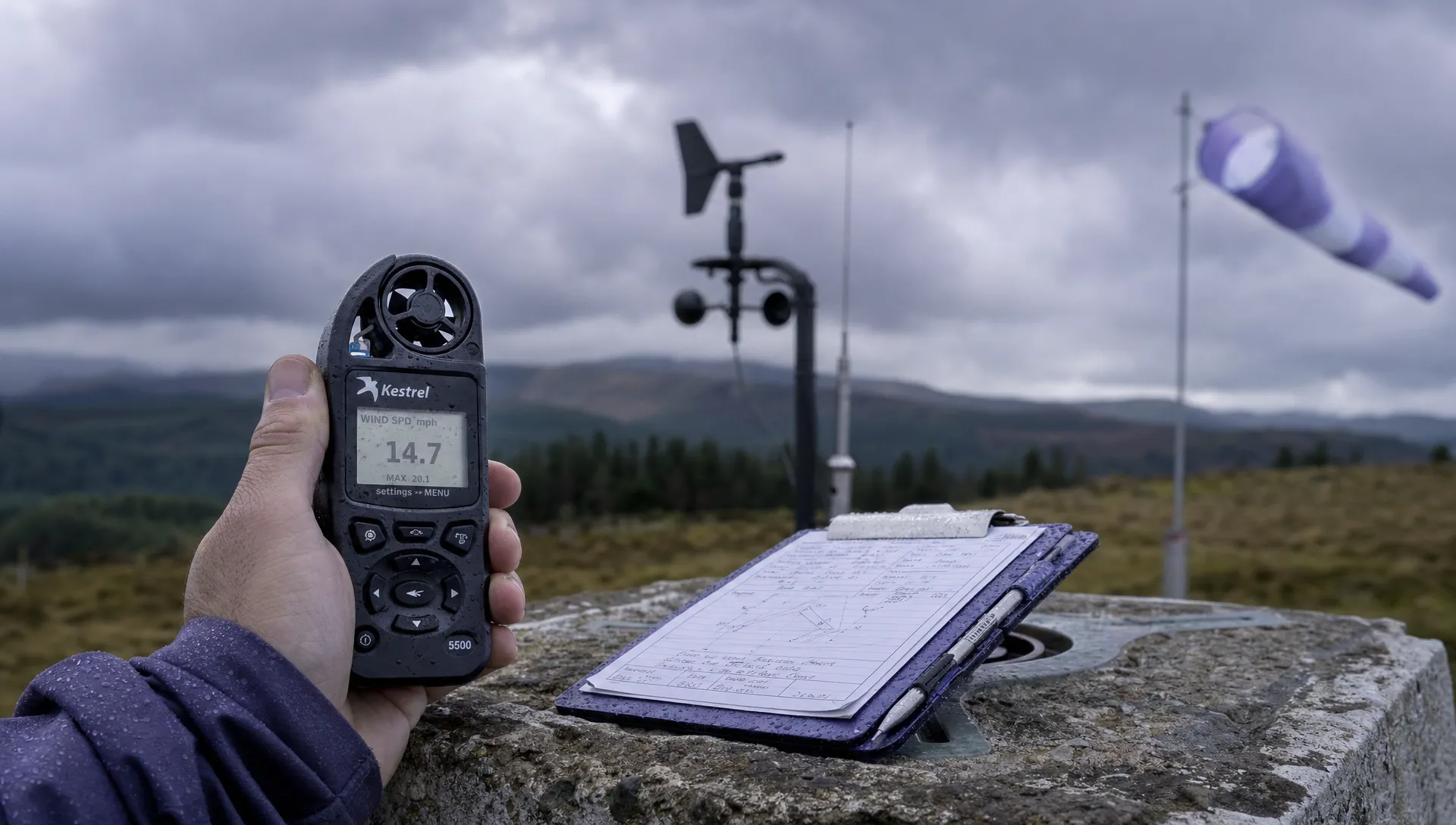
A handheld anemometer can support the ground assessment when used in a representative, unobstructed position. It cannot prove that conditions aloft are acceptable. If local observations contradict the forecast, resolve that uncertainty before committing to the mission.
Check precipitation, visibility and moisture separately
Rain, showers and thunderstorms
A low probability of rain does not describe the intensity or timing of any shower that develops. Inspect the forecast alongside radar, noting whether precipitation is approaching, forming locally or clearing. Radar shows recent conditions, so extrapolating movement is not a guarantee of what happens next.
Check the aircraft’s permitted environmental conditions in its documentation. An ingress-protection rating is not blanket approval to operate in any rain. Aircraft, payload, connectors and supporting equipment may have different restrictions.
Thunderstorms introduce hazards beyond rainfall, including lightning, abrupt wind changes and strong local gusts. Do not assume that a dry launch point means an approaching storm is irrelevant. Set a conservative stand-down and shelter plan before the weather reaches the site, rather than waiting for rain or aircraft warnings to trigger action.
Fog, low cloud and condensation
A weather app for drone flying should help you identify reduced-visibility risk, but the final assessment needs to reflect what you can actually see across the operating area. Fog can be patchy, particularly near water or in low ground, so a clear launch site does not establish a clear route.
Temperature close to dew point signals conditions favourable to condensation or fog, although it does not guarantee either. Treat that narrowing gap as a reason to inspect local visibility and moisture more closely.
Moving cold equipment into warm, humid air can also produce condensation. Allow equipment to acclimatise as appropriate and check lenses before collecting data. Do not treat cloud-base and horizontal-visibility forecasts as interchangeable: either can compromise the task independently.
Temperature, batteries and icing
Check ambient temperature against the permitted ranges for the aircraft, battery and payload. Cold conditions can reduce available battery performance, while heat can affect equipment before launch if it is left in direct sun or a hot vehicle.
Follow the manufacturer’s battery-temperature procedures and reassess the energy reserve for the planned route. A forecast temperature alone does not establish that the battery is ready to fly.
Cold air combined with visible moisture raises icing concerns. Unless the aircraft documentation explicitly supports those conditions, do not assume that a short flight makes them acceptable. Moisture exposure and its effect on the aircraft matter, not just the thermometer reading.
Assess whether the weather will support useful data
Safe aircraft operation and successful data collection are separate decisions. A weather app for drone flying should support both, especially when a repeat visit would disrupt a survey programme or asset inspection.
For photogrammetry, changing illumination, moving vegetation and motion blur can affect image consistency and reconstruction. Steady overcast may suit some visual tasks better than rapidly alternating sunshine and cloud, but requirements depend on the subject and capture method.
Thermal inspections need a task-specific weather assessment. Solar heating, wind and wet surfaces can change the apparent temperature pattern. Agree suitable conditions with whoever will interpret the results, rather than applying a general “good flying weather” threshold.
For emergency operations, urgency does not remove environmental constraints. Establish what information the mission needs to deliver and whether another observation method would be more suitable if weather prevents a useful flight.
Build weather checks into the mission workflow
Before travelling
Review the expected conditions across the full job window, including setup and likely delays. Compare relevant forecasts and identify disagreement that could change the decision, such as one model predicting a shower band while another remains dry.
Set explicit reassessment triggers: an approaching shower, deteriorating visibility, rising gusts or observations outside the planned envelope. Agree who makes the launch and stop decisions. The weather assessment should connect to your drone flight risk assessment, not sit in a separate screenshot folder with no operational consequence.
At the site
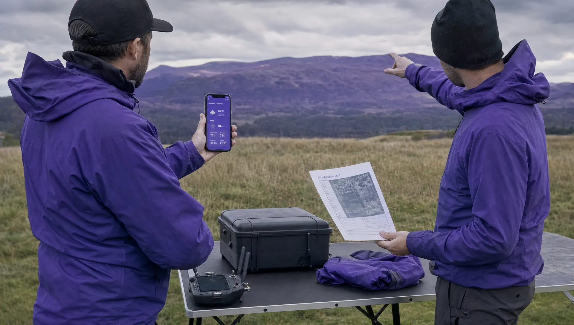
Refresh the weather app for drone flying and compare its prediction with the conditions in front of you. Check the entire operating area where practicable, including exposed sections, likely return routes and the landing zone.
Record representative observations, their time and the measurement method. A wind reading taken behind a vehicle or wall may underestimate the exposure the aircraft will encounter. Note that limitation rather than treating the number as definitive.
Use three clear decision states: proceed within the assessed conditions, hold while resolving uncertainty or do not launch because conditions fall outside the plan. A forecast being within an aircraft specification is not enough if visibility, data quality or the return route remains unsuitable.
If you change the route or shorten the mission, reassess the revised plan. A smaller job is not automatically a safer one if it retains the same weather exposure.
During the operation
Monitor trends rather than checking only at take-off. Watch for changing visibility, approaching precipitation, increased positioning effort and unexpected battery consumption.
Aircraft warnings and observed behaviour deserve immediate attention, even when the forecast still looks favourable. Use your established abort and landing procedures rather than continuing while trying to explain away the difference.
Recheck after meaningful delays or between sorties. The next battery does not inherit the weather assessment from the previous flight if conditions have changed.
Keep evidence that helps the next decision
Save the forecast source, issue time, valid period, site observations and the reason for the decision. A green icon without context provides little useful evidence later.
After a flight, compare what your weather app for drone flying predicted with what the team encountered. Record recurring differences at exposed or sheltered sites, without assuming that one flight establishes a reliable local rule.
For DJI operations, the Dronedesk DJI flight log analysis tool can support a post-flight review alongside the weather record. Flight logs are not a direct meteorological measurement and should not be used alone to infer wind conditions. Keep the distinction between recorded aircraft behaviour and observed weather clear.
Frequently asked questions
What is the best weather app for drone flying? Choose one that clearly shows gusts, direction, relevant forecast heights, precipitation, visibility and update times. Use it alongside local observations and aircraft-specific procedures. A tool that exposes uncertainty is more useful than an unexplained fly/no-fly score.
Can I fly when wind is below the manufacturer’s stated limit? Not on that fact alone. Assess gusts, turbulence, payload, battery condition, visibility and the return route. The mission and your operating procedures may require a more conservative limit.
Should I trust the forecast or an on-site wind reading? Use both, recognising their limitations. A ground reading may miss conditions aloft and a forecast may miss local effects. Investigate significant disagreement before launching.
Does a low Kp index mean conditions are suitable? No. Kp describes geomagnetic activity, not local flying weather, and it is not a direct measurement of positioning performance at your site. Check aircraft positioning status and warnings through the appropriate operating procedures.
Make the decision repeatable
Use the same weather assessment structure across your team, while keeping limits specific to each aircraft, site and task. Record what was checked, what remained uncertain and why the operation proceeded or stopped.
When reviewing your wider operational workflow, compare Dronedesk’s features with your team’s requirements. Use these weather checks to identify what your planning and decision records need to capture.
 Drones for Commercial Use: How to Match Aircraft to Risk →
 Weather App for Drone Flying: Checks Beyond Wind Speed →
 How to Assess a Drone Flying Conditions App Before a Mission →
 How to Compare a Drone Flying Weather App for Site Teams →
 Drone Flight Software: A Buyer’s Guide for Multi-Site Work →
 BVLOS Drone License: Understanding the US Approval Path →
 How to Build a Drone Business Operations Manual →
 Part 107 License Records Every Commercial Operator Needs →
 Drone Checklist Design Tips for High-Pressure Missions →
 Drone Software Integration Checklist for Growing Teams →